Ground Penetrating Radar
.jpg)
GPR (Ground Penetrating Radar) systems enable operators to detect underground utilities, particularly non-conductive pipes and ducts, using high-frequency Radar. When locating underground utilities, GPR can be a valuable complement to electromagnetic cable and pipe locators.
Radiodetection's RD1100™ and RD1500™ innovative GPR systems both use ultra-wide band 250MHz, specifically chosen for effective utility locating. Our GPR products feature internal GPS and high resolution touch screens.
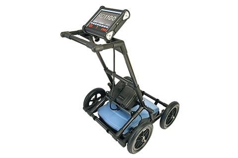
The RD1100™ Ground Penetrating Radar detects both conductive and non-conductive underground utilities using wide-band radar technology and features internal GPS, on-board Wi-Fi and a high resolution touch screen.
Radiodetection’s RD1100 provides high-performance subsurface imaging for buried utilities in a rugged and competitively priced GPR system. Designed for the utility industry, the RD1100 features a wide-band sensor capable of detecting plastic and ceramic utilities at depths of up to 8m / 27’ deep.
Its high resolution touch screen display adds to its ease of use, including the ability to draw arrows directly on the screen to highlight subsurface features of interest.
Screenshots are taken with a single button press and saved to internal memory as JPGs. These can be exported later to a USB memory stick or emailed by connecting to a Wi-Fi network or by using a cell phone as a hotspot. Instant information, higher productivity!
GPS positioning is captured alongside the Line View data for integrating into geo-referencing packages.
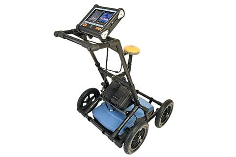
RD1500™ Ground Penetrating Radar is Radiodetection's flagship GPR for utility locating. The RD1500 provides all the great features of the RD1100 and also offers Depth Slices as well as Line Views.
These allow the user to review slices of the subsurface at different depths, displaying cables, pipes and other utilities in unprecedented clarity.
The RD1500 is designed to find buried pipes and cables. Features include internal GPS, on-board Wi-Fi, a high resolution touch screen as well as the proprietary FrequenSee™ technology which selectively enhances small/shallow, medium size/depth, or large/deep targets, or even all at once, for easier viewing and detection.
Mini reports can be generated and delivered directly from the survey site by connecting to a Wi-Fi network or by using a cell phone as a hotspot.
Data can also be exported to a USB memory stick. Options for the RD1500 include: an external GPS, for higher positional accuracy the Enhancement package, which enables the user to slice through the exported depth data, export data to other formats and more the Utility Suite software option offers features such as processing and displaying grid data in alternative ways, and the ability to output data to 3D visualization software such as Voxler®.

